Our community
Our Shire in the vast West Kimberley region is home to 8,433 residents across 54 communities and 3 towns, spanning over 120,146 square kilometres. It encompasses pastoral stations, businesses, and renowned tourism spots like the Gibb River Road, the Fitzroy River, the Devonian Reef, and Horizontal Falls.
Established as the West Kimberley Road District in 1961, our Shire has evolved significantly. The broader West Kimberley area features over 100 km of sealed and 1,500 km of unsealed roads, linking more than 40 pastoral stations.
The Kimberley experiences two distinct seasons—Wet and Dry—each year, characterized by cyclones, intense heat, rain, and thunderstorms. The Dry season (April – Oct) is particularly popular, attracting around 113,000 visitors annually from across Australia.
Our population is predominantly Aboriginal, comprising 64% and representing approximately 17 distinct language groups. Each group has an Indigenous Seasons calendar which describes each season and its attributes.
Our language groups
We are home to several Kimberley Aboriginal Languages in our Shire, including Warrwa, Bardi, Jawi, Ngarinyin, Worrorra, Nyikina, Mangala, Unggumi, Bunuba, Walmajarri, Kija, Gooniyandi, Oogardang, Oomeday, Yow Jabi and Wangkatjunka people.
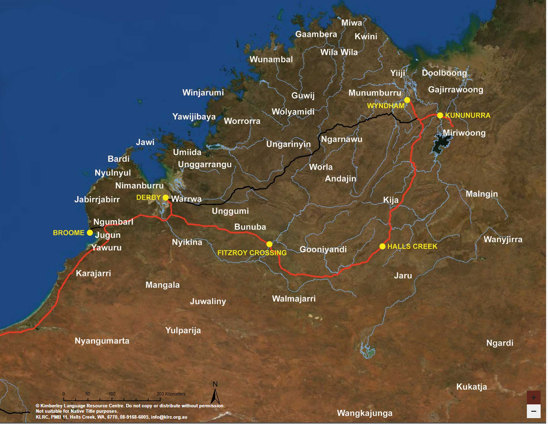
Disclaimer: The Kimberley Language Resource Centre (KLRC) acknowledges that there are dialects not represented on this map. This map cannot be used within land claims and does not represent Native Title boundaries. This map may not be copied or reproduced without this disclaimer. Please contact the KLRC with any comments or concerns, or to request a copy of this map.
Our organisation
The Shire of Derby/West Kimberley provides a range of services, including corporate, development, infrastructure and community services as well as economic and executive services for our community.